 |
|
|
Yosemite Valley is the most popular place for tourists. With a hotel and numerous campsites, this is where most overnight Yosemite visitors stay. Yosemite Valley also contains Yosemite Village, which has a general store, a post office, and the Yosemite Visitors Center. There are many breathtaking views of both the Yosemite Falls and Half Dome from the Valley, which I've already shown on their respective pages. This page contains the lesser-known, but just as beautiful, landmarks. |
|
|
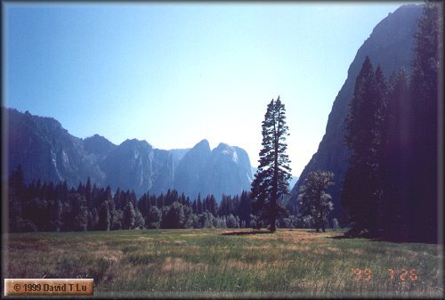
The Yosemite Valley runs more or less east-west, with steep cliffs on both north and south. The Yosemite Falls are on the north side of the valley, Glacier Point is on the south, and Half Dome is on the southeast. This shot is a view looking southwest in the late afternoon. |
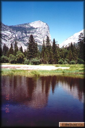 |
This shot shows a reflection of Mt. Watkins on Mirror Lake,
at the eastern end of Yosemite Valley.
There was a gentle breeze, plus ducks and kids,
so I was unable to get a still lake for a perfect mirror.
Due to the constantly changing ecosystem in the park, Mirror Lake is, in more recent years, slowing becoming Mirror "Swamp." The water level in the lake has dropped, causing several "islands" to pop up. The white beach and grassy vegetations is such an island. The other side of the lake is actually where the tall trees are. |
|
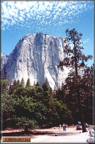
The El Capitan is another famous Yosemite landmark.
It is the first major (and very striking) landmark you
see when entering Yosemite Valley.
The rock is actually much larger than what appears here.
Bridalveil Fall is across the road.
El Capitan is popular among the die-hard rock climbers. It takes a few days to scale. Rock climbers take scaffolds up with them that they can hang on the cliff for overnight stays. When driving past one night, we saw tiny speckles of light at various distances up the cliff. |
|
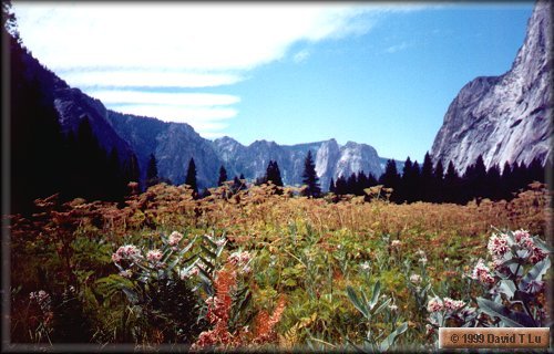
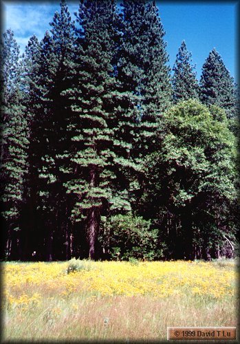
Flower fields are common in the valley, though you're more likely to see them in Spring, rather than Summer, which is when I was there to take this shot. |
|
A sunflowers field in Yosemite Valley. This is at Stoneman Meadow, across from Curry Village. |
.jpg)
(digital) |
A tiny stream runs along part of a trail in the Valley. Biking is a popular activity. There are bike trails everywhere. In fact, it is probably easier to get around on a bike than to drive a car or with the Valley's free shuttle bus. |
.jpg)
(digital) |
A hollowed trunk along a trail. You can see through the trunk to the ground on the other side. |
.jpg)
(digital) |
A really pretty trail in the Valley. There are many nice trails off the main road, away from all the people and the exhaust fumes. I was on this particular trail for about an hour and ran into only a few people. |
|
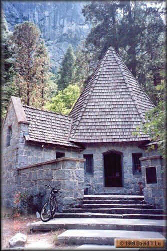
LeConte Memorial. It's a nice little building staffed by a very friendly Sierra Club volunteer. There are historical information, photos, and other artifacts on Joseph LeConte and John Muir, two famous naturalists, adventurers, and Yosemite pioneers. |
.jpg)
(digital) |
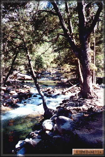
Happy Isles, on the southeast side of the Valley. Water flows very fast here, coming down from the mountains and entering the Valley. This is the mouth of the Merced river for the Valley. Merced River originates from Merced Lake, much further upstream and beyond the Vernal and Nevada Falls. |
|
More fast-moving water at Happy Isles. The water is squeezed by the narrowness of the Merced in this area. The Merced is much wider further downstream. |
.jpg)
(digital) |
My favourite Happy Isles shot. Another picture of the Merced River rapids. |
.jpg)
(digital) |
Happy Isles suffered significant flood damage in 1997.
A main bridge there has yet to be repaired.
Park officials have decided to leave some of the devastation
in-place, so visitors can appreciate just how powerful nature can be.
I saw huge rocks embedded in the trunks of
hundreds-year-old trees, as if the trees were mere clay.
Giant trunk carcasses strewn as if thrown
by a lawnmower.
Probably best to just leave the place as-is.
Cleaning up would require Herculean efforts.
On the left is a tree at Happy Isles, teared in half with a force that only nature cam muster. The upper trunk, facing the camera, has been sawed off because it protrudes into the trail. |
.jpg)
(digital) |
.jpg)
(digital) On the left is a tree balanced precariously on the stump of I believe another tree. This is obvious a work of nature, probably from the same 1997 flood. This is near Swinging Bridge, on the west end of the Valley and much further downstream from Happy Isles. On the top is a sign, at about eye level, that shows the flood level at 11pm on January 2, 1997. This sign is between Yosemite Village and Curry Village. |